Landranger 176 - West London Area
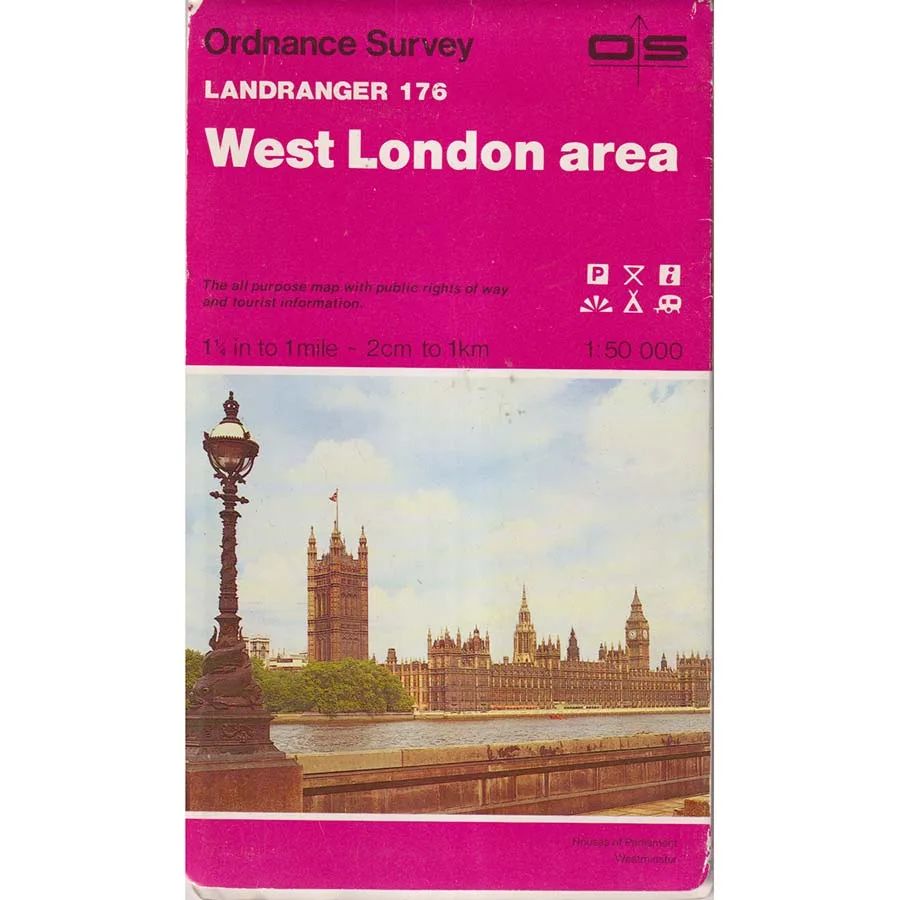
Publisher: Ordnance Survey
Format: Paperback
ISBN: 9780319221761
Before satellite navigation began directing motorists into rivers, private driveways and the occasional field containing an understandably surprised cow, travelling around West London required a remarkable piece of technological equipment: a folded paper map. It had no batteries, no irritating electronic voice and absolutely no interest in collecting your location data. Unfortunately, it also required the user to possess a basic understanding of geography, which occasionally proved an unreasonable expectation.
Landranger 176 – West London Area (1986), published by Ordnance Survey, is a splendid cartographic survivor from an era when finding your way across the western approaches to the capital involved consulting grid references, examining road junctions and occasionally admitting that the passenger holding the map might actually know what they were talking about.
Produced at the classic 1:50,000 Landranger scale, where two centimetres represent one kilometre, this map offers a detailed view of West London and its surrounding landscape during the mid-1980s. Roads, railways, rivers, settlements, woodland and countless geographical features are carefully recorded with the meticulous enthusiasm for which Ordnance Survey has long been celebrated.
The area itself provides a fascinating mixture of urban development, suburban expansion and surviving countryside. Here, the vast machinery of London gradually encounters the towns, villages and open spaces beyond its western boundaries, producing a landscape in which historic settlements coexist with modern transport networks and the occasional road system apparently designed by someone with a personal grudge against motorists.
Published in 1986, this edition captures an intriguing moment in Britain’s recent history. Margaret Thatcher occupied Downing Street, mobile telephones were still largely the preserve of wealthy executives, and the M25 was approaching completion, promising to revolutionise travel around London by providing an entirely new location in which motorists could sit stationary for extended periods.
For modern readers, the map offers more than directions. It is a geographical time capsule, recording the landscape before decades of housing developments, road improvements, commercial expansion and other ambitious attempts to make travelling around London simultaneously easier and more complicated.
Collectors, local historians and anyone interested in the changing geography of the capital will find considerable pleasure in comparing this vintage edition with modern maps. Familiar roads may appear in different configurations, developments may be absent, and places now absorbed into continuous suburbia retain traces of their earlier identities.
Naturally, this 1986 map should not be relied upon as the sole guide for present-day navigation. Forty years provide ample opportunity for a road to acquire additional lanes, an entirely new roundabout or a collection of traffic restrictions that would have seemed unnecessarily imaginative in the 1980s.
Condition: Good. This vintage Ordnance Survey edition is a previously owned copy showing ordinary signs of age, use and handling, but remains an appealing example of traditional British cartography.
Offered by Crappy Old Books, where we admire accurate mapping, appreciate historical geography and remember when getting lost was an adventure rather than evidence that your software required updating.
A charming vintage map for collectors, London enthusiasts and anyone nostalgic for the days when navigating the capital required a little intelligence, a decent map and the courage to admit that one had taken the wrong turning.
Keep browsing: See more Maps books Other books by Ordnance Survey